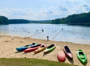
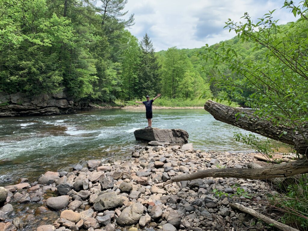
Deep Creek, and the greater Garrett County area, is home to a wide variety of hiking trails for all levels and ages. From trails that take you to the highest point in the state, to trails running alongside rivers, lakes and waterfalls, Western Maryland has it all! These are the absolute best hiking trails in the Deep Creek Lake, Maryland area.
I have personally hiked all but two of these trails. We are not avid hikers, by any means, but we do enjoy getting out and exploring the beauty of Western Maryland!
The All Trails app is really helpful to use for these hikes because cell service can by spotty. Download the trail map on the app before you go and you will have access to it for your entire hike, even without cell service. Garrett Trails is another helpful website with trail descriptions.
Hiking poles and boots are not required for all of the trails, but I have noted in the descriptions the trails that they are useful for.
Swallow Falls State Park Hiking Trails
Swallow Falls Canyon Trail: 1.1 Miles Roundtrip, Easy
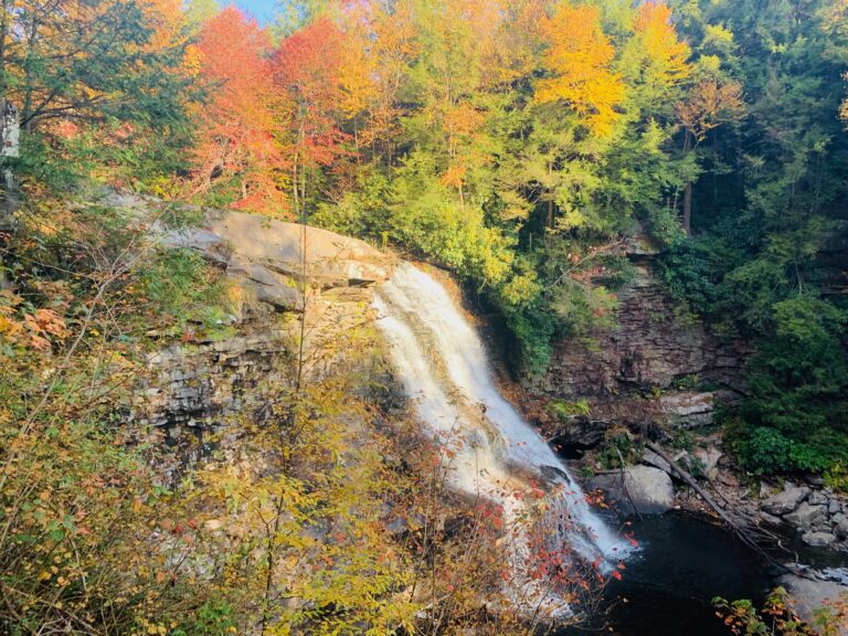
If you only do one hike off of this list, make it the Swallow Falls Canyon Trail! This one mile loop takes you past 4 stunning waterfalls along the Youghiogheny River: Muddy Creek Falls, Upper Swallow Falls, Lower Swallow Falls and Tolliver Falls.
Muddy Creek Falls is the tallest free-flowing waterfall in the state of Maryland. Swallow Falls State Park is beautiful in every season, but fall is my favorite–when the leaves are at peak foliage!
When the trail starts, you come to a fork only a few yards onto the trail. If you go left at the fork, Muddy Creek Falls is only a short walk in that direction. If you don’t have the time or desire to do the 1 mile loop, then just go left to see Muddy Creek Falls.
If you do the whole mile loop, I recommend going RIGHT at the fork, and going counter-clockwise to take advantage of the downhill trail in this direction. Going counter-clockwise means you will start with the smaller waterfalls and end with the grand finale of Muddy Creek Falls . You will have to climb a staircase at the end of the hike.
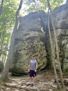
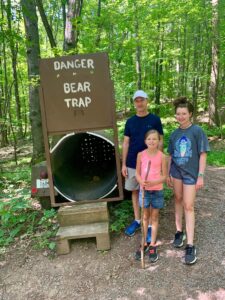
The Rock Maze is one of the most unique trails in the Deep Creek area. Its name comes from the large field that is littered with huge rock boulders, creating a maze of sorts. The boulders are fun to climb and the trail is enjoyable for all ages! The trailhead is at Fork Run Recreation Area and is part of the Garrett State Forest. Use this address for GPS directions: 3739 Snaggy Mountain Road, Oakland, MDView on All Trails.
Savage River State Forest Hiking Trails
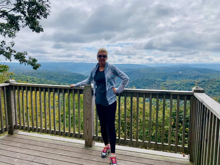
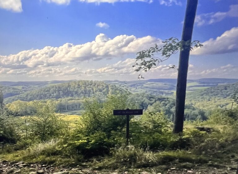
Meadow Mountain Trail Overlook: 1.7 Miles Out & Back, Easy
The entire Meadow Mountain Trail is 14 miles long, but there are several trails that take you through small portions of it. The most popular section is the Meadow Mountain Trail Overlook, which you access from Frank Brenneman Road. This easy gravel trail takes you to a stunning overlook, which on a clear day, allows you to see for miles! View on All Trails.
Whitewater Worlds Loop: 0.8 Miles Roundtrip, Easy
This loop trail takes you along the beautiful Savage River. View on All Trails.
Meadow Mountain Trail Overlook
Savage River State Forest Trails, Continued
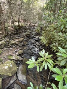
Monroe Run Trail: 9 Miles Out & Back (or as short as you want); Moderate
The Monroe Run Trail has multiple stream crossings throughout the almost 5 miles one way trail. If you aren’t up for a 9 mile hike, you can go as far as you’re comfortable with and turn around. The first stream crossing is only a mile in. Hiking boots and hiking poles are helpful for the stream crossings. View on All Trails.
Savage River Bridge Loop: 0.7 Miles Roundtrip, Easy
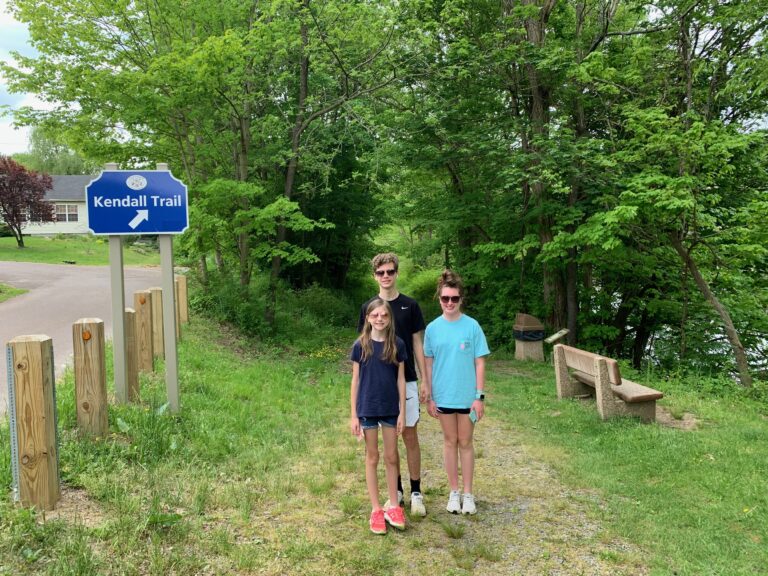
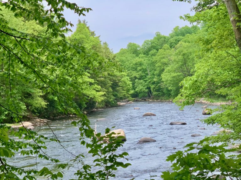
The Kendall Trail is a scenic hike along the banks of the Youghiogheny River. It is ranked as a moderate 5 miles out and back, but you could go in as far as you are comfortable and turn around at any point to make it shorter and still have beautiful scenery. This hike can be muddy in parts, so wear shoes that you don’t mind getting dirty! View on All Trails.
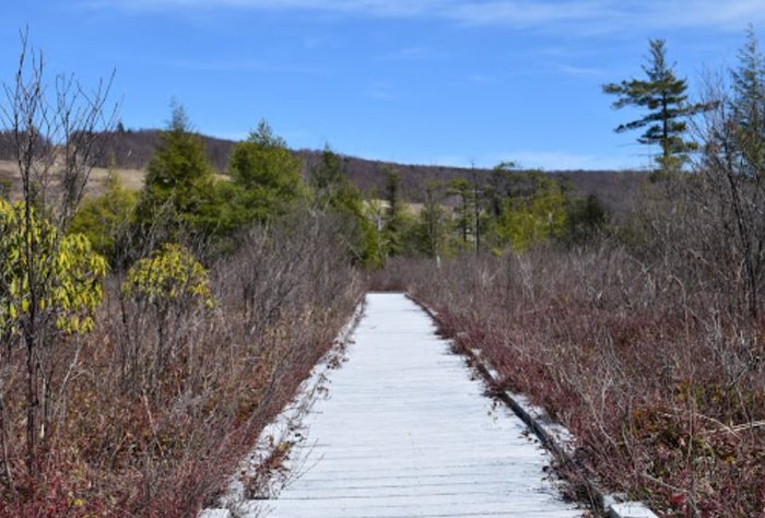
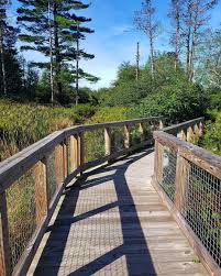
Cranesville Swamp Hiking Trail
The Cranesville Swamp Trail is an easy 1.2 mile roundtrip hike. It is located just over the West Virginia border, only 25 minutes from Deep Creek. The first part of the trail is dirt, then it turns into a boardwalk in the middle over the swamp and then back onto a dirt trail. If it has recently rained, hiking boots are helpful, as you will likely walk through some water in the swamp area. View on All Trails
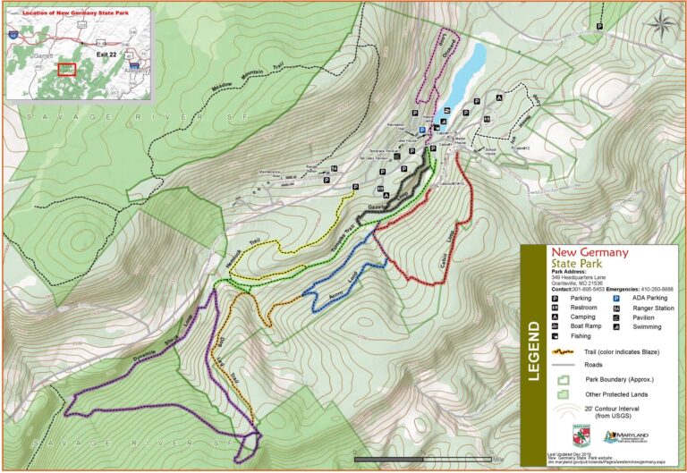
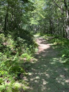
New Germany State Park
The trails at New Germany State Park meander along several streams, making for a scenic hike!
Turnpike Trail & Hemlock Trail: 2 Miles Roundtrip, Easy
Dynamite Shack Loop: 5.6 Miles Roundtrip, Moderate
The trails at New Germany are all clearly marked, and connect in one big loop, or you can take individual trails for a shorter hike. If you want to do the full 5.6 mile roundtrip hike, you would take the Turnpike Trail (green) to Dynamite Shack Loop (purple) to Dog Leg Trail (orange) to Acorn Loop (blue) back to Turnpike Trail. View on All Trails
Turnpike Trail (Green) New Germany State Park
Dynamite Shack Loop Trail (Purple)-New Germany State Park
Potomac/Garrett State Forest Hiking trails
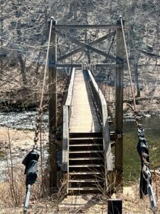
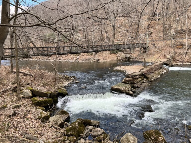
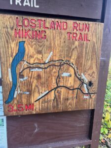
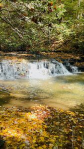
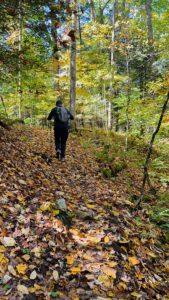
Lostland Run Trail: 8 Miles Out & Back, Moderate; Can Make Shorter
This is a great hike that takes you by Cascade Falls waterfall and has several stream crossings, along with some fun suspension bridges. The trailhead is across from the ranger station, however there is also a trailhead and parking lot at the very end of the trail, along the Potomac River. The best parts of the hike are towards the end of the trail, so if you don’t want to do the full 8 mile hike, you can start at the bottom and see the suspension bridges and falls on a shorter hike.
To get to the bottom trailhead, if you keep driving on Lostland Run Road, past the official trailhead…after about 2 miles the road ends at the bottom trailhead. Note that this road turns into a very narrow, one-way gravel road. I actually thought we were lost because it didn’t even seem like a road at one point, but it is. At the end of the road there is a parking lot and you will see the trailhead.
Wear hiking boots and bring hiking poles. You will want poles for the slippery stream crossings.
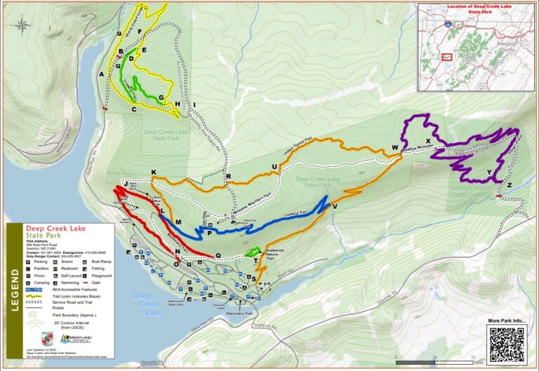
Deep Creek Lake State Park
Snakeroot Nature TrailviaIndian Turnip Trail: 1.2 Miles Roundtrip, Easy
The Snakeroot Nature Trail (green) is a great family friendly hike. Use this self guided brochure to explore the flora and fauna on this easy nature hike. View on All Trails.
Cherry Creek Loop: 2.8 miles Roundtrip Easy to Moderate
Cherry Creek Loop (yellow trail) is ranked easy on All Trails, but due to the rockiness and hills it is on the more moderate side of easy. View on All Trails.
Beckman’s Trail to Brant Coal Mine: 2.6 Miles Roundtrip, Moderate
Beckman’s Trail (red trail) is accessed at the overflow parking lot in Deep Creek Lake State Park. This trail takes you past the old Brant Coal Mine, which is interesting to see. Take Meadow Mountain Trail (white trail) to return back to the starting point. View detailed trail information on All Trails.
Indian Turnip Trail: 5 Miles Roundtrip, Moderate
For the 5 mile roundtrip hike, take Indian Turnip Trail (orange)to Lookout Trail (blue) to Beckman’s Trail (red) to Meadow Mountain Trail (white) which takes you back to the beginning of Indian Turnip Trail (orange). This will also take you past the Brant Coal Mine on the return trip.
Beckman's Trail
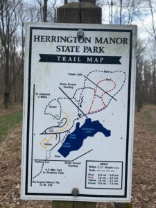
Herrington Manor State Park
Herrington Manor Park Loop Blue: 3.4 Miles Roundtrip, Easy
The blue Herrington Manor Park Loop is 3.4 miles roundtrip and a flat, grassy hike. View on All Trails
Herrington Manor Park Loop Red: 1.6 Miles Roundtrip, Easy
The red Herrington Manor Park Loop is the shorter version of the blue. Begin on the blue loop and then take the roundtrip red trail back to the blue.
Herrington Manor to Swallow Falls Trail 12 miles Out & Back, Moderate
This trail, which takes you from Herrington Manor State Park to Swallow Falls State Park, is worth doing if you have two cars and can leave one on each end, making it only a 6 mile hike. View on All Trails.
Hoye Crest Trail-Maryland’s High Point
Hike a moderate 2.3 miles out and back to get to the summit of the state of Maryland at 3,360 feet above sea level. The view from the top is worth the steady incline. View on All Trails.
Town Trails
Oakland Town Trail: 2.9 Miles Roundtrip; Easy
This trail starts at the Farmers Market in Downtown Oakland. It is a roundtrip hike on All Trails, but most people do out and back, as the “loop” takes you on a road back. View on All Trails.
Kitzmiller River Walk: Easy
The Kitzmiller River Walk is a paved trail that walks along the Potomac River with beautiful scenery. There is also a botanical garden located at the entrance to the River Walk.
Kitzmiller River Walk
Loch Lynn Heights Wetlands Trail, Easy
The Loch Lynn Heights Wetlands Trail is a short, easy trail that starts on a boardwalk with gazebos overlooking the wetlands, then continues along the Youghiogheny River.
Final Thoughts
Hiking was one of the top things to do in Deep Creek in every season. Be sure to explore all of my Deep Creek guides at the bottom of this page, including Where to Stay in Deep Creek.
Creating detailed travel guides takes time and love-your support helps keep this blog going. Buy me a virtual coffee if you’d like to say thanks! (Just a small tip-not an actual drink!) ☕